
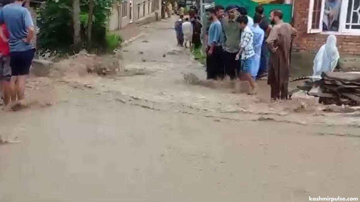
SRINAGAR — A flood-like situation was witnessed in Keller area of southern Kashmir’s Pulwama district on Saturday after the cloudburst occurred at Chowgam Kellar area while the rains lashed most parts of Jammu and Kashmir, bringing down the mercury across the Union Territory.
As per the details available with the news agency KNO, the cloudburst at Chowgam Kellar led to a flood-like situation today as the muddy water entered several residential houses. Although no damage occurred due to the incident, the muddy water has entered the residential houses in the hamlet today, the locals informed.
Flash floods also hit Achgoza village in the Valley's southern district of Pulwama. The village in Rajpora Tehsil of the district experienced severe disruption last night due to flash floods triggered by a cloudburst in the nearby forest area.
Independent weather forecaster Faizan Arif Keng said the sudden cloudburst resulted in the rapid accumulation of water, submerging the village and several residential properties.
A local resident described the situation, saying the water rose so quickly that they had no time to react. "Within minutes, our homes were submerged, and we had to evacuate hastily."
Another resident expressed relief that the water levels are now receding. Currently, water levels are decreasing, allowing villagers to begin assessing the damage and cleaning up.
DC Pulwama, Basharat Qayoom said the situation is being closely monitored and efforts are underway to provide necessary assistance to the affected families.
Meanwhile, below normal temperature was recorded at all the stations across Jammu and Kashmir as the rainfall continued from the wee hours of this morning till the afternoon.
As per the details, Srinagar, the summer capital of Jammu and Kashmir has recorded a rainfall of 8.8mm from 8:30 this morning to 5:30 in the evening.
Qazigund, a gateway of Kashmir, has recorded a precipitation of just 1.2mm while Pahalgam recorded 6.2mm during the period. Kupwara, Kokernag and Gulmarg recorded precipitation of 1.3mm, 1.4mm and 2.2mm respectively.
According to the details, Jammu’s Batote has recorded the highest precipitation with 24.9mm in the last 24 hours till 8:30 am followed by 4.8mm in Banihal.
Meanwhile, the weatherman has predicted the possibility of a brief spell of rain and thundershower at a few places during daytime and light to moderate rain and thundershower at many places of J&K towards late night or early morning during the next three days till August 20.
Director Meteorological Department (MeT), Dr Mukhtar Ahmad said that there is a possibility of a brief spell of rain and thundershower at a few places during daytime and light to moderate rain and thundershower at isolated places of J&K towards late night or early morning from August 21 to August 23.
The MeT has also predicted the possibility of intense showers for brief periods and heavy rainfall in Jammu division that may lead to flash floods, landslides, mudslides and shooting stones over vulnerable places of J&K during the next three days.
This post first appeared on The Kashmir Pulse
Post a Comment
Refrain from posting comments that are obscene, defamatory or inflammatory, and do not indulge in personal attacks, name calling or inciting hatred against any community. Let's work together to keep the conversation civil.